
This item is Discontinued.
This item is Discontinued.
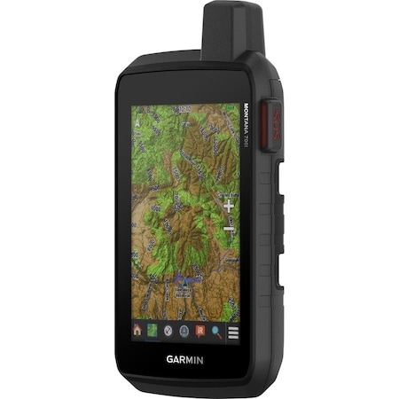
Garmin 010-02347-10 Montana 700i Rugged GPS Touchscreen Navigator with inReach Technology (Discontinued)
Mfr #
010-02347-10
Zoro #
G704054542
UPC # 753759257736
Country of Origin Taiwan, Province of China
Category Navigation & GPS Systems

Unlock 30-day payment terms
Business customers can apply for Net 30—no fees, no interest, fast approval.
Terms apply.

Get 10% off your order
Sign up for our email list and receive your promo code via email.
Specifications
Product Information
- MFR #
- 010-02347-10
- Zoro #
- G704054542
- UPC #
- 753759257736
- Country of Origin
- Taiwan, Province of China
Description
Ability to trigger an interactive SOS to the GEOS 24/7 monitoring center or use of the full QWERTY touchscreen keyboard for 2-way messaging via the 100% global Iridium satellite network (active satellite subscription required
Pro-connected with ANT+(R) technology, Wi-Fi(R) connectivity and Bluetooth(R) wireless networking, giving user direct-to-device access to BirdsEye Satellite Imagery downloads, location sharing, Connect IQ app support, and more
Compatible with the Garmin Explore website and app to help user manage waypoints, routes, activities and collections, use tracks, and review trip data from the field
Features- Features rugged military-grade construction and a 5 in. touchscreen display that's 50% larger than the previous model
- Some jurisdictions regulate or prohibit the use of satellite communications devices)
- Multi-GNSS (GPS and Galileo) support-plus preloaded TopoActive maps and City Navigator street map navigation
- Rechargeable Li-Ion battery pack can provide more than 18 hours of battery life in GPS mode and 1 week in Expedition mode between charges
- Includes Li-Ion battery pack, USB cable, and documentation
- Two-way Messaging - Exchange text messages with loved ones, post to social media, or communicate via inReach device to inReach device in the field
- Interactive SOS - In case of emergency, trigger an interactive SOS message to GEOS, a professional 24/7 global monitoring and response center
- Global Connectivity - Instead of relying on cellphone coverage, now your messages, SOS and tracking are transferred via the 100% global Iridium satellite network
- Display Size: 2.55"W x 4.25"H (6.48 x 10.80 cm); 5" diag (12.70 cm)
- Display Resolution: 480 x 800 pixels
- Display Type: WVGA transflective, dual orientation
- Battery Type: rechargeable lithium-ion (included)
- Mil-Std-810: yes (thermal, shock, water, vibe)
- Interface: high speed micro USB and NMEA 0183 compatible
- Memory/History: 16 GB (user space varies based on included mapping)
- Automatic Routing (Turn By Turn Routing On Roads): Yes (with optional mapping for detailed roads)
- Map Segments: 15000
- Birdseye: yes (direct to device)
- External Memory Storage: yes (32 GB max microSD card)
- Waypoints/Favorites/Locations: 10000
- Tracks: 250
- Track Log: 20000 points, 250 saved gpx tracks, 300 saved fit activities
- Routes: 250, 250 points per route; 50 points auto routing