BlueChart g3 Vision HD, VUS513L, Jacksonville, Bahamas, microSD /SD
Mfr # 010-C0742-00
Zoro # G511108391
product price: $429.99
/ea
Free Shipping & Returns
Get a 10% off coupon
Free 30-day returns
Return PolicyGet 30 days to pay with Net 30
Apply NowReal support from real people
Contact our U.S. based teamSpecifications
Product Information
MFR #
010-C0742-00
Zoro #
G511108391
UPC #
753759069223
Country of Origin
United States
Description
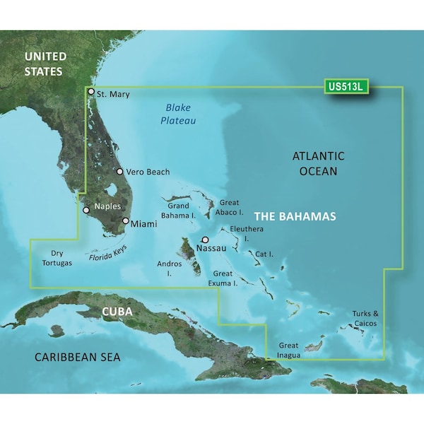
BlueChart g3 Vision HD - VUS513L - Jacksonville - Bahamas - microSD /SD Coverage:Detailed coverage of the Florida Peninsula from St. Mary's, GA through the Port of Miami to Fort Myers on the Gulf. Coverage includes the St. Johns River, Crescent Lake, Lake George, Lake Monroe, Lake Jesup, Lake Harney, Lake Okeechobee, the St. Lucie Canal, and Caloosahatchee R. in full. Detailed coverage also includes the Florida Keys, Bahamas and Turks and Caicos Islands. Bathymetric coverage of offshore features from Blake Canyon through Santaren Channel to the Torgtugas Terrace, including the Blake Escarpment and Great Bahama Bank.Premier Coastal Navigation ChartsProvides industry-leading coverage, clarity and detail with updated coastal charts that feature integrated Garmin and Navionics dataAuto Guidance technology uses your desired depth and overhead clearance to calculate routes and show a suggested path to followHigh-resolution relief shading combines color and shadow to give you an easy-to-interpret, clearer view of bottom structure than contour lines aloneDepth Range Shading provides up to 10 depth ranges, enabling you to view your target depth at a glanceUp to 1' contours provide a more accurate depiction of the bottom structure for improved fishing charts and navigation in swamps, canals and marinasExperience unparalleled coverage and brilliant detail on the water. BlueChart g3 Vision coastal charts provide industry-leading coverage, clarity and detail with integrated Garmin and Navionics data, Auto Guidance technology and high-resolution relief shading. Auto Guidance TechnologyThe Auto Guidance feature uses your desired depth and overhead clearance to calculate a route and a suggested path to follow.High-resolution Relief Shading FeatureHigh-resolution relief shading combines color and shadow to give you an easy-to-interpret, clearer view of bottom structure than contour lines alone.Up to 1' ContoursThe closer the contour lines, the more accurate the depiction of the bottom structure for improved fishing charts and navigation in swamps, canals and marinas.NOAA Raster CartographyIf you prefer your display to have the look of paper charts, NOAA raster cartogr
Documents & Resources
Ratings & Reviews
3 Reasons You Can Count On Us

Supplies for every job.
10 million items and the exact one you need.

When you need it fast, count on Zoro!
2 million products ship in 1 day.

Stretch your budget further.
Everyday low prices on the brands you love.