Navionics+ NSSA012R Brazil
Mfr # 010-C1453-20
Zoro # G112300033
product price: $149.99
/ea
Free Shipping & Returns
Get a 10% off coupon
Free 30-day returns
Return PolicyGet 30 days to pay with Net 30
Apply NowReal support from real people
Contact our U.S. based teamSpecifications
Product Information
MFR #
010-C1453-20
Zoro #
G112300033
UPC #
-
Country of Origin
United States
Description
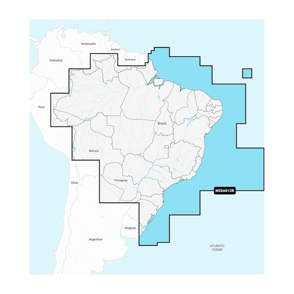
Navionics+ NSSA012R Brazil Featuring vibrant colors, a streamlined interface, and combined coastal/inland content with a popular Navionics style color palette, Garmin Navionics+ cartography makes it easy to plot courses with the world No. 1 name in marine mapping. microSD/SD format Navigate with the best offshore and inland lake coverage for a Garmin chartplotter Customize the view with various chart layers and overlay combinations With the included one-year subscription, access daily updates via the ActiveCaptain smart-device app Auto Guidance+ technology2 lets users navigate with suggested dock-to-dock routings Select up to 10 color-shaded target depth ranges to scope out the best fishing spots Save money by renewing the subscription — and continue accessing daily updates plus new content downloads Coverage Detailed coverage of the coast of Brazil. Also including the Amazon River from Benjamin Constant to the Atlantic Ocean. All-In-One Map Solution for Garmin Chartplotters Access detail-rich mapping of coastal features, lakes, rivers, and more. Integrated Garmin and Navionics content offers coverage for boaters worldwide. Daily Chart Updates Charts are constantly being enhanced with new and amended content — as many as 5,000 updates are made every day. The one-year subscription includes access to daily chart updates via the ActiveCaptain app. Auto Guidance+ Technology Combining the best of Garmin and Navionics automatic routing features, built-in Auto Guidance+ technology2 gives users a suggested dock-to-dock path to follow through channels, inlets, marina entrances, and more. Depth Range Shading High-resolution depth range shading lets users select up to 10 color-shaded options and view the designated target depths at a glance. Up to 1’ Contours For improved fishing and navigation, up to 1ft contours provide a clear depiction of bottom structure for improved fishing charts and enhanced detail in swamps, canals, harbors, marinas, and more. Shallow Water Shading To give a clear picture of shallow waters to avoid, this feature allows for shading at a user-defined depth. ActiveCaptain Com
Ratings & Reviews
3 Reasons You Can Count On Us

Supplies for every job.
10 million items and the exact one you need.

When you need it fast, count on Zoro!
2 million products ship in 1 day.

Stretch your budget further.
Everyday low prices on the brands you love.