MAX NA-M026 - Great Lakes & The Maritimes - C-Card (Discontinued)
- Mfr # NA-M026C-CARD
- Zoro # G4674398
Get a 10% off coupon
Free 30-day returns Return Policy
Get 30 days to pay with Net 30 Apply Now
Unlock tax-exempt savings Add Tax Exemption
Specifications
Product Information
MFR #
NA-M026C-CARD
Zoro #
G4674398
UPC #
-
Country of Origin
United States
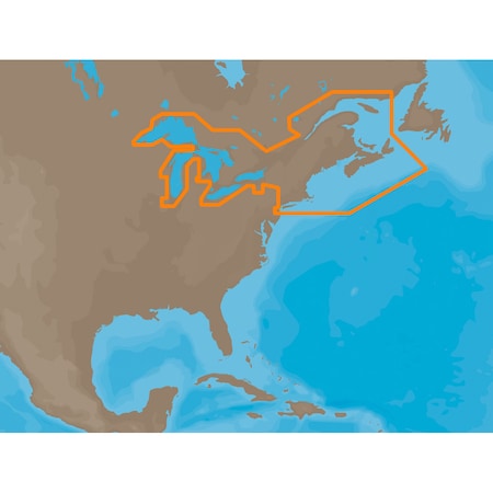
Description
NA-M026 => Great Lakes, Northeast Coast and Approaches Coverage of the Great Lakes, St. Lawrence River and Northeast United States. Coverage of the Great Lakes also includes Fox River and Lake Winnebago, Lake St. Clair, Rideau Canal, Ottawa River and the Trent-Severn Waterway. Includes all coastal charts for New Brunswick and Nova Scotia in Canada and Maine, New Hampshire, Massachusetts, Connecticut and New York in the U.S. Also included is coverage of the Hudson River and Lake Champlain as well as the Erie Barge Canal.
Ratings & reviews
3 reasons you can count on us

Supplies for every job.
10 million items and the exact one you need.

When you need it fast, count on Zoro!
2 million products ship in 1 day.

Stretch your budget further.
Everyday low prices on the brands you love.